
Trail Sense 8.2.0
This contains a list of the changes in Trail Sense 8.2.0.
Field Guide
Multiple Images for a Page
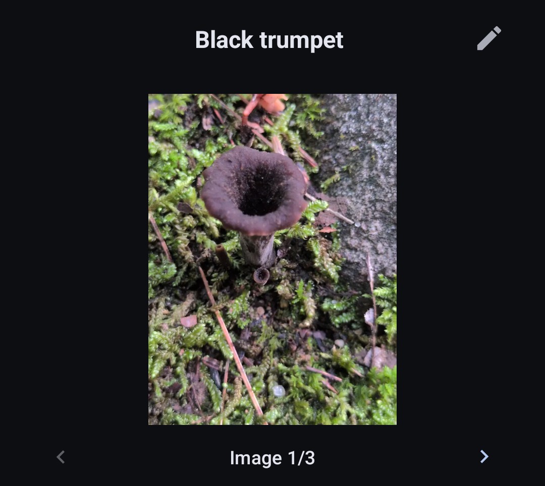
You can now attach multiple images to a field guide page. Use the arrows or swipe to view them. The default image can be set using the menu button on the image while editing the page.
Color Sighting Markers on Map Layer Based on Classification
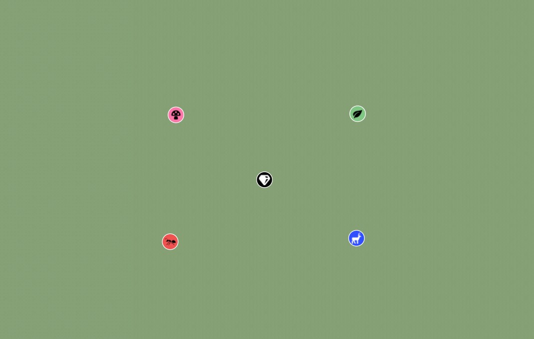
By default, the Sightings map layer will change the color of the sighting markers based on the classification (e.g., plant vs. fungus). This is available as a layer setting if you want to turn it off or switch to it instead of the sighting images.
Scientific Names
You can now enter scientific names on field guide pages and optionally choose to display them wherever the page name is shown.

Minor Changes
- The open button on the map layer and record sighting snackbar now opens the sighting you clicked on rather than the field guide page
- When a sighting is opened, clicking back will always bring you through the sighting list and field guide page before returning to where you came from
- The field guide page name is now shown on the sightings list and entry page
- You can now delete a sighting from the entry page
- You can now hide built-in pages
Miscellaneous
Minor Changes
- Added notification channel groups in the system notification settings page
- Displayed clock offset from system time in the Clock tool (thanks to @arpitagarwal1301 for the contribution)
- Increased font size of the location sheet in the Navigation tool (thanks to @arpitagarwal1301 for the contribution)
- Added distance and direction to the selected point sheet on the map (thanks to @Maqbool61 for the contribution)
- Added diagnostics for when an alarm notification channel is blocked
- Added a button in the Diagnostics tool to export logs to a zip file
- Added messaging on the Signal Finder tool for when the location permission is denied
- Improved map tile memory usage
- Improved messaging when an offline map fails to import
- Changed the "unknown" sensor status badge color to gray
- Added a setting to adjust the navigation bearing length (thanks to @Maqbool61 for the contribution)
- Added the ability to export trail maps (thanks to @Maqbool61 for the contribution)
- Country and state/province boundaries are now visible on trail maps (if available in the .map file)
- Cell signals are now sorted by full service first and then signal strength
- The recommended apps user guide page was moved to GitHub (https://github.com/kylecorry31/Trail-Sense/discussions/4002)
- Added angle text for the center bubble level (thanks to @darrencoen for the contribution)
- Reduced sensor update frequencies on some tools
- Enabled text suggestions and capitalization in text inputs across the app
- Added last updated time to weather list (thanks to @Hitesh-XS for the contribution)
- Translation updates. Thank you to all the translators!
Bug Fixes
- Fixed a bug where opening the keyboard on the sightings or packing list item pages could cover the notes section
- Increased the padding below the destination bearing in the navigation sheet (thanks to @Maqbool61 for the contribution)
- Improved performance of solar eclipse tile layer when there is no eclipse
- Improved performance of group loading (beacons, offline maps, paths)
- Fixed a bug where the astronomy chart seek bar in centered mode did not cover a full 24 hours
- Fixed a bug where the Augmented Reality tool would drop a segment of rendered lines
- Fixed a bug where the pedometer activity recognition permission setting would go away when background location was granted but activity recognition was not
- Fixed a bug where a daily weather forecast time close to midnight would not fire
- Fixed a bug where the tide phase arrow on the map layer would not show in the early morning
- Fixed a bug where the tide phase arrow on the map layer did not render properly between low and high tide
- Fixed a bug where the nearby tide widget would not update with location changes
- Fixed a bug where late December climate values could be inaccurate
- Fixed a bug where insect activity dates could report shorter periods than they are actually active
- Fixed a bug on the Climate tool where clicking a precipitation month when you have a different year selected would change back to the current year (thanks to @Maqbool61 for the contribution)
- Fixed a bug where a cancelled or failed packing list export would report as "Exported" (thanks to @Maqbool61 for the contribution)
- Fixed a bug where a cancelled delete map dialog on the photo map view screen would kick you back to the map list (thanks to @Maqbool61 for the contribution)
- Fixed a crash on the Triangulation tool when the same location is entered twice
- Fixed a bug where the white noise timer ending would not close the timer section while watching it stop (thanks to @Maqbool61 for the contribution)
- Fixed a bug where map attribution could overlap the distance bar
- Renamed "Stride length" to "Step length" to accurately reflect what is being used
- Fixed a bug where the pedometer reset button didn't immediately clear the average speed
- Fixed the migration of pedometer steps on some older Android devices
- Potentially fixed a bug on Fairphone where the weather monitor would not start unless background location was granted
- Potentially fixed a crash on the Fairphone when leaving the Sensor tool open for a minute
- Fixed a bug where pressing enter on the search bar would insert a new line (thanks to @Ajay-S-Biradar for the contribution)
- Fixed a bug where Augmented Reality paths would render many more points than they should have
- Fixed a bug where the weather monitor would not pick up frequency changes unless restarted
- Fixed a bug where the widget updater reported the wrong frequency on the battery tool
- Many more preventative bug fixes (https://github.com/kylecorry31/Trail-Sense/issues/3914)